
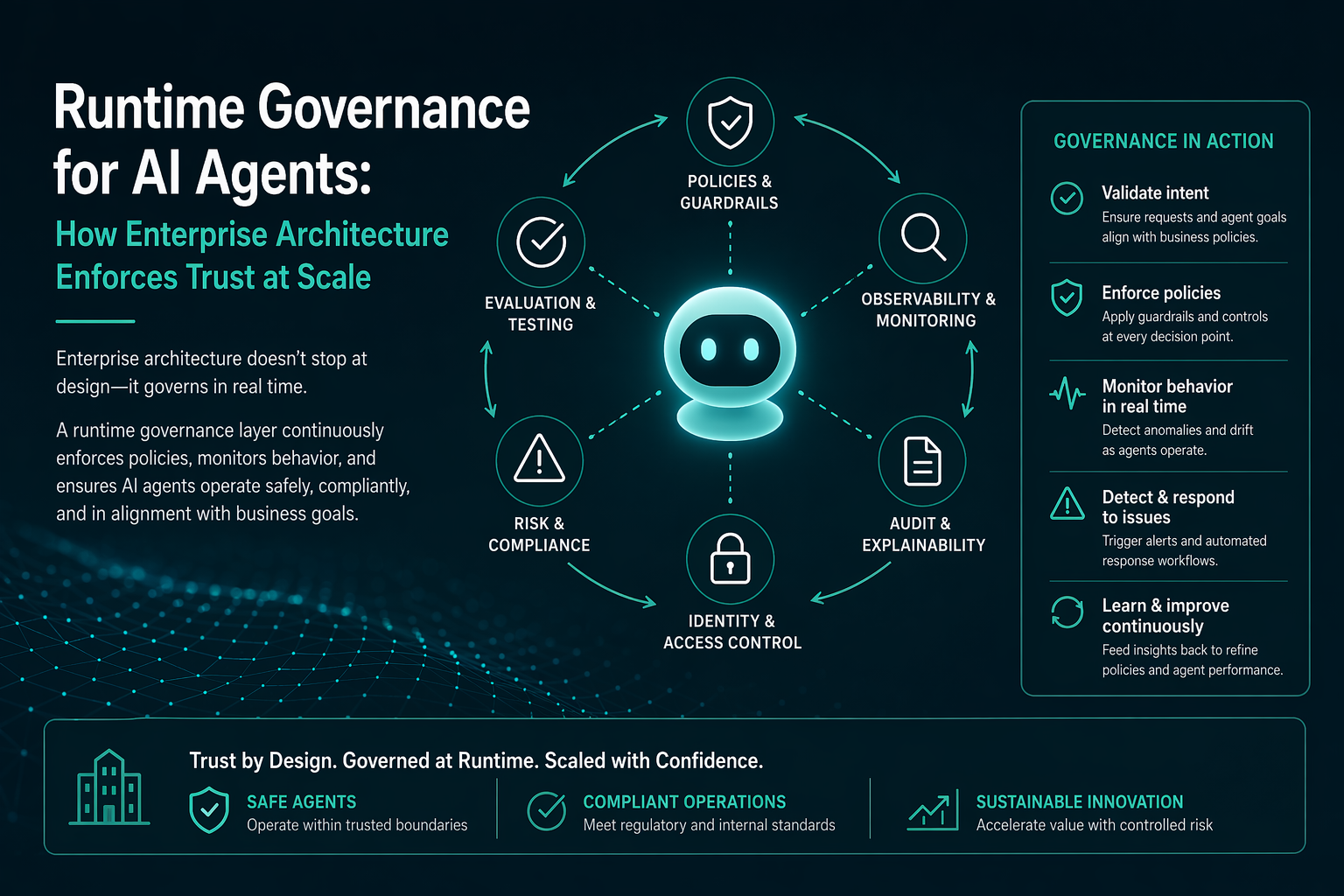
 The UK Environment Agency have been providing free access to their mapping tools for non-commercial means for some time now. This is their LIDAR (Light Detection & Ranging) data. However the non-commercial bit is about to change with the addition of commercial use also becoming free to use in the near future.
The release of data will be through the OGL (Open Government Licence) which itself will see an update in September 2015
The main driver behind this change is to assist with risk modelling and to open up innovation around the environment.
We hope that by removing any cost barriers, our data will improve the quality of flood risk modelling used by businesses and local communities and allow for the development of innovative tools and techniques to further benefit the environment.
Dr Alison Matthew,Geomatics Manager at the Environment Agency

Leave a Reply